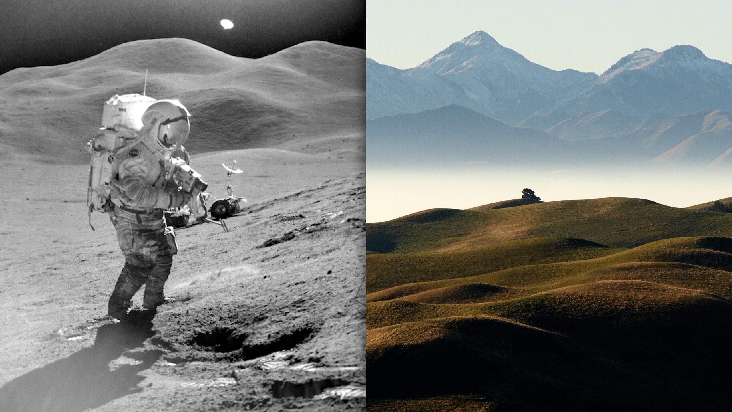
This is the Sea of Tranquility, the area where humans first walked on the Moon – and this is Arizona. If these pictures weren’t labeled, there would be almost no way of telling them apart. Each crater is exactly the same, down to the size and location. This isn’t some weird hoax, nor is it a physical phenomena – this place was meticulously created by NASA to look just like the Moon. With the help of explosives, this random field in Arizona was instantly transformed into the most Moon-like place on Earth. Nowadays, the craters have been mostly reclaimed by nature. But why did NASA create this place and what did they do there?
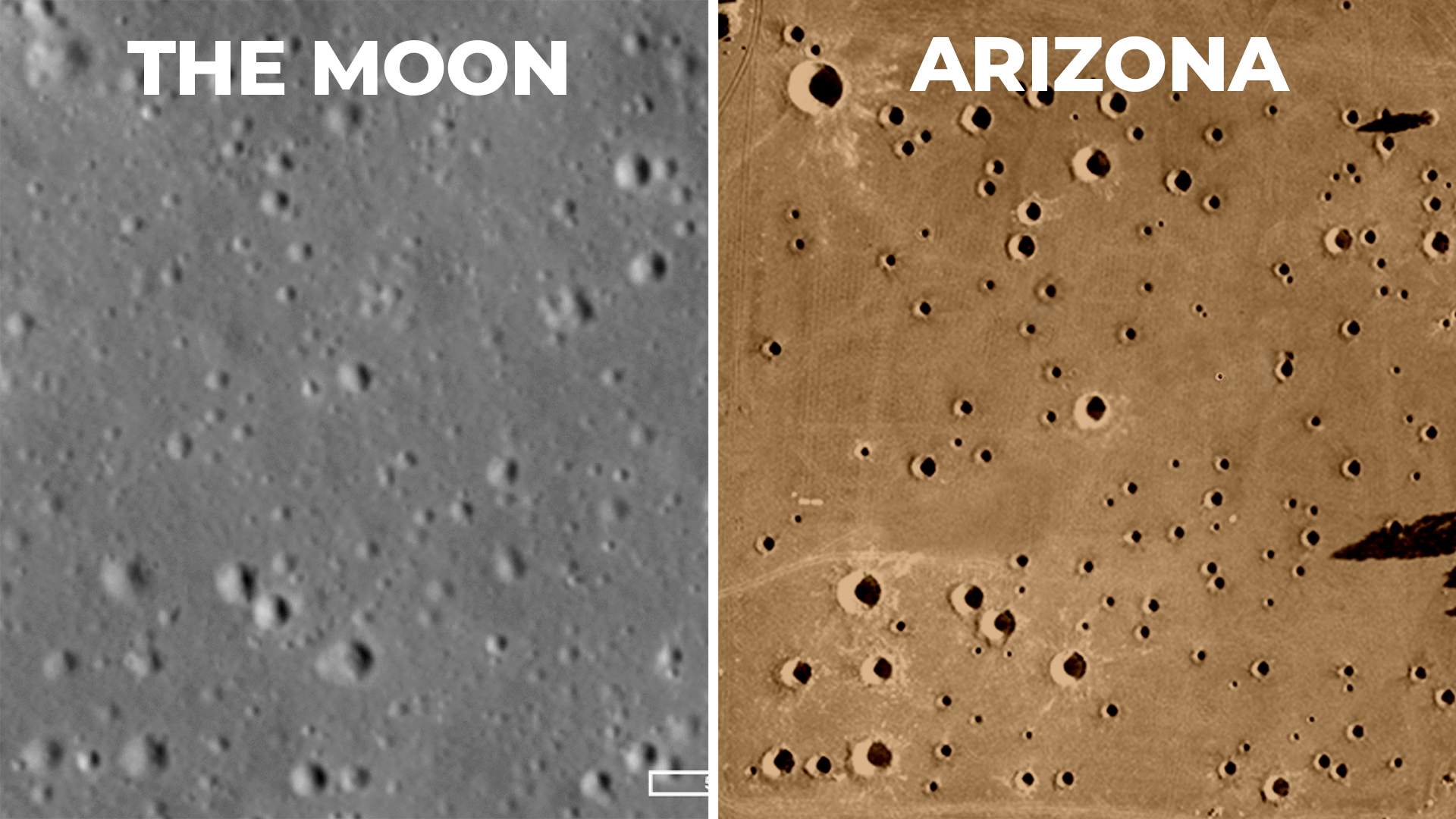
In this article, we’re going to look at the incredible lengths NASA went to in order to get humans on the Moon.
Preparing for the Moon
In the late 60’s, NASA were closing in on their first trip to the Moon. But the question was, what would they do when they got there? Back then, very little was known about how the Moon formed and the materials that made up its surface. The most detailed images we had were from the Lunar Orbiter satellites, which only had a resolution of about 2 meters. With these images, only the largest craters could be seen – and the fine details on the surface were still unknown.
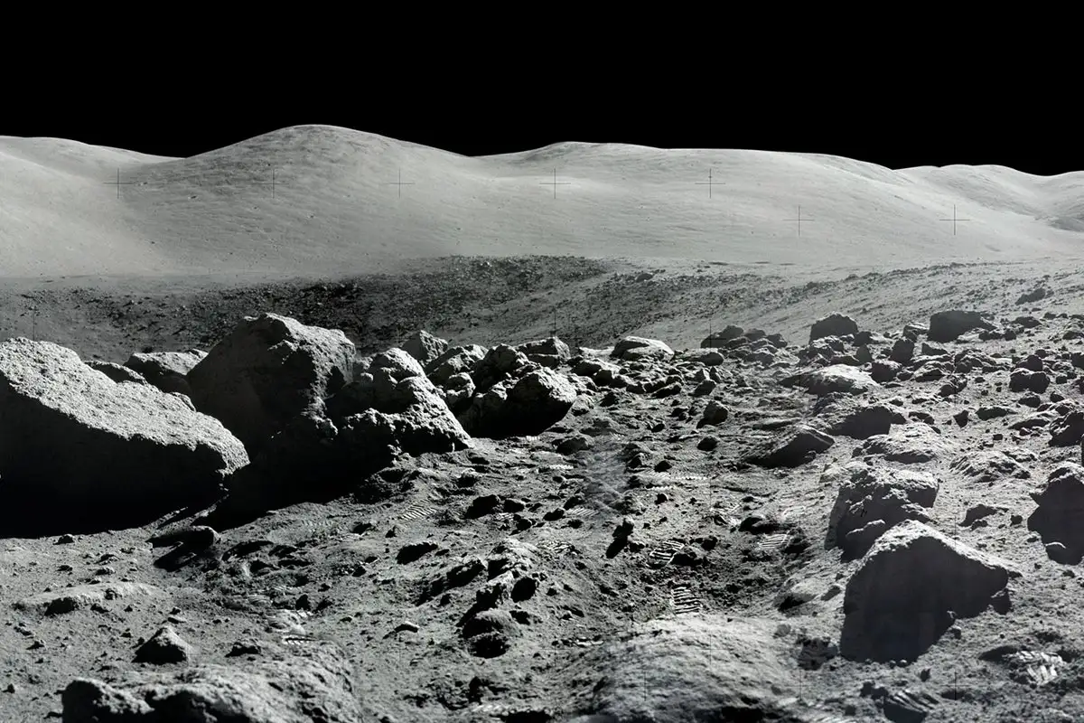
And so with NASA about to put humans on the Moon, they realized that studying the rocks, craters and materials on the surface could teach us a lot about how the Moon and Earth came into existence. The problem was, the astronauts’ time on the Moon was very limited – and so maximizing the amount of science learned from each trip was absolutely crucial. That’s where Cinder Lake came in.
Cinder Lake
Before astronauts ever stepped foot on the Moon, they had to become experts in geology. They had to be able to just look at a crater and determine how old it was. They had to be able to give detailed descriptions of rocks and materials as they were walking around the Lunar surface. And so, NASA set out to recreate the Moon’s surface – and it all happened in this field near Flagstaff, Arizona.
Located next to a former Volcano, this field was covered in volcanic gravel, which NASA thought would be similar to the material on the Moon. But creating a 1 to 1 scale model of the Apollo landing site was far from easy.
Making the crater field
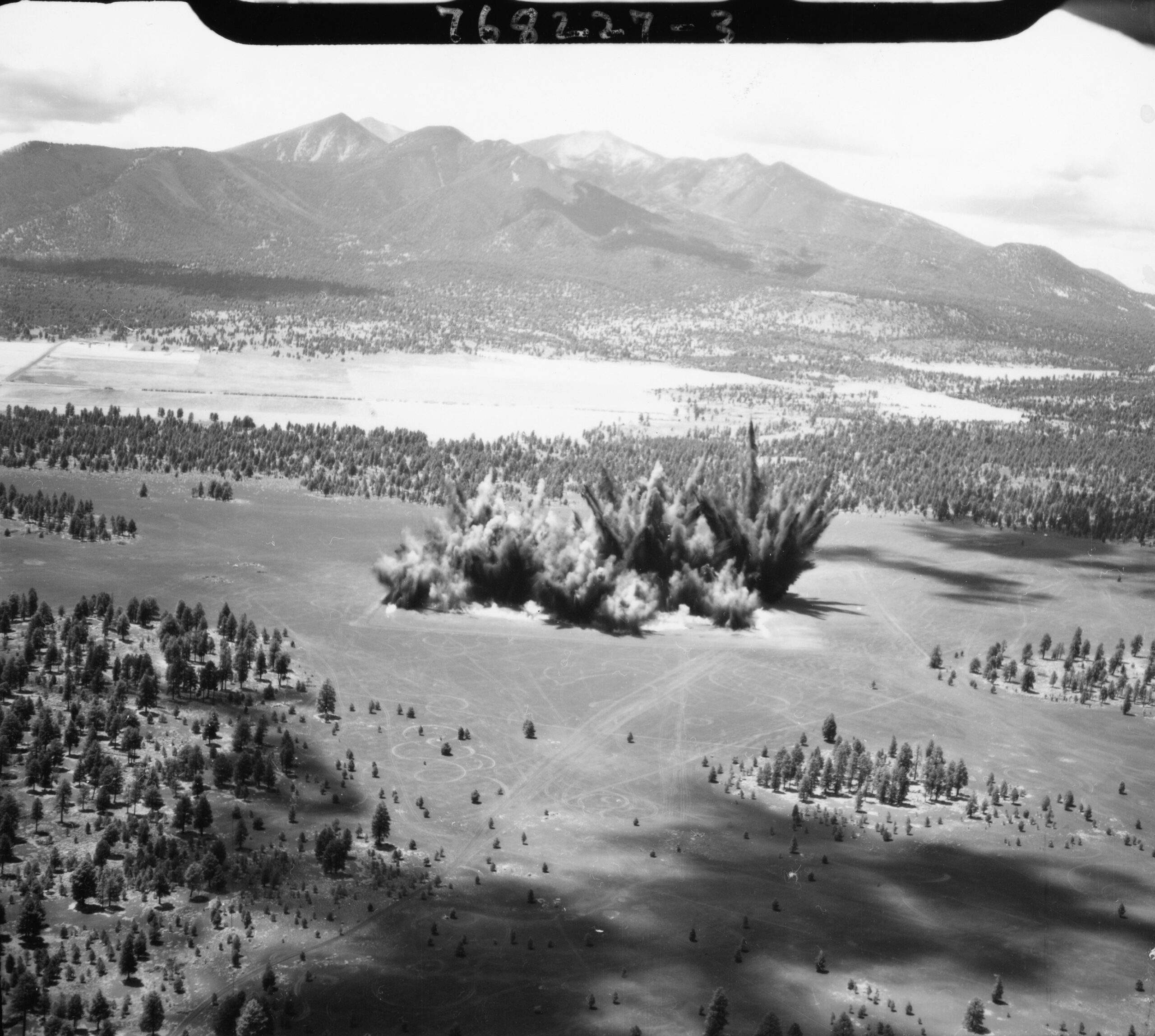
In order to turn this field into the surface of the Moon, the team in Arizona used *pause*… That’s right, dynamite. Not only were they trying to match the exact size and location of each crater, but they also wanted to replicate the different ages of each crater. Based on the Lunar Orbiter photos, NASA could determine the relative ages using something called superposition.
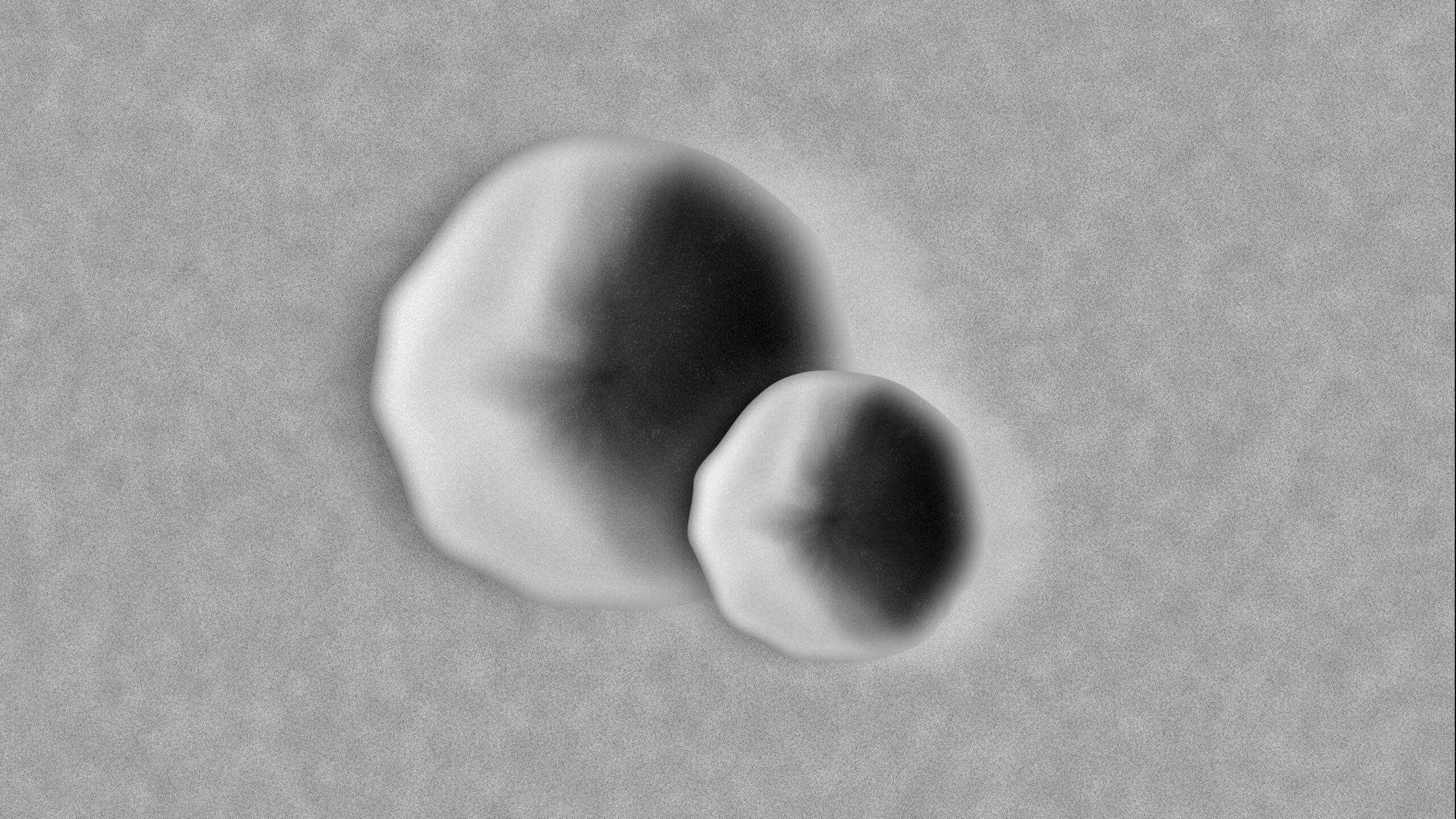
This is the simple principle that younger craters will lie on top of older craters. So if a meteor hits an existing crater, it will destroy part of the rim and create a fresh circle on top. If we look at this set of craters, it’s obvious that the larger crater was made first and then the smaller ones came later. And so, in order to replicate the different ages, the team in Arizona marked out all 143 craters and split them up into 3 different categories: new, intermediate and old.
They placed precise amounts of dynamite under every crater mark to get the right sizes and blew them in sequences, starting with the oldest craters first and working their way through to the newest ones. The result was incredible. In an instant, this random field in Arizona was transformed into an extremely accurate depiction of the Apollo 11 landing site. But what did NASA do with this place?
Pinpointing their location on the Moon
One of the first problems the astronauts would have to overcome when landing on the Moon was figuring out where they actually were. Although NASA had a landing site in mind, the actual spot the astronauts touched down could be anywhere within 5 kilometers of this area.
Without knowing exactly where the astronauts had landed, NASA wouldn’t be able to guide them to the most interesting craters or track where they had gone. This made NASA ask the question, could astronauts accurately locate their location just by comparing their view from the Lunar Module to a map of the surface? This was where Cinder Lake came in very handy.
A mockup of the Lunar Module was placed at a random location in the Cinder Lake crater field and 28 test subjects were each given 30 minutes inside to try and find their location. A large portion of the test subjects were actually geologists – some were mathematicians, some surveyors and the rest had a wide range of backgrounds. Even with prior experience, this is a very difficult test.
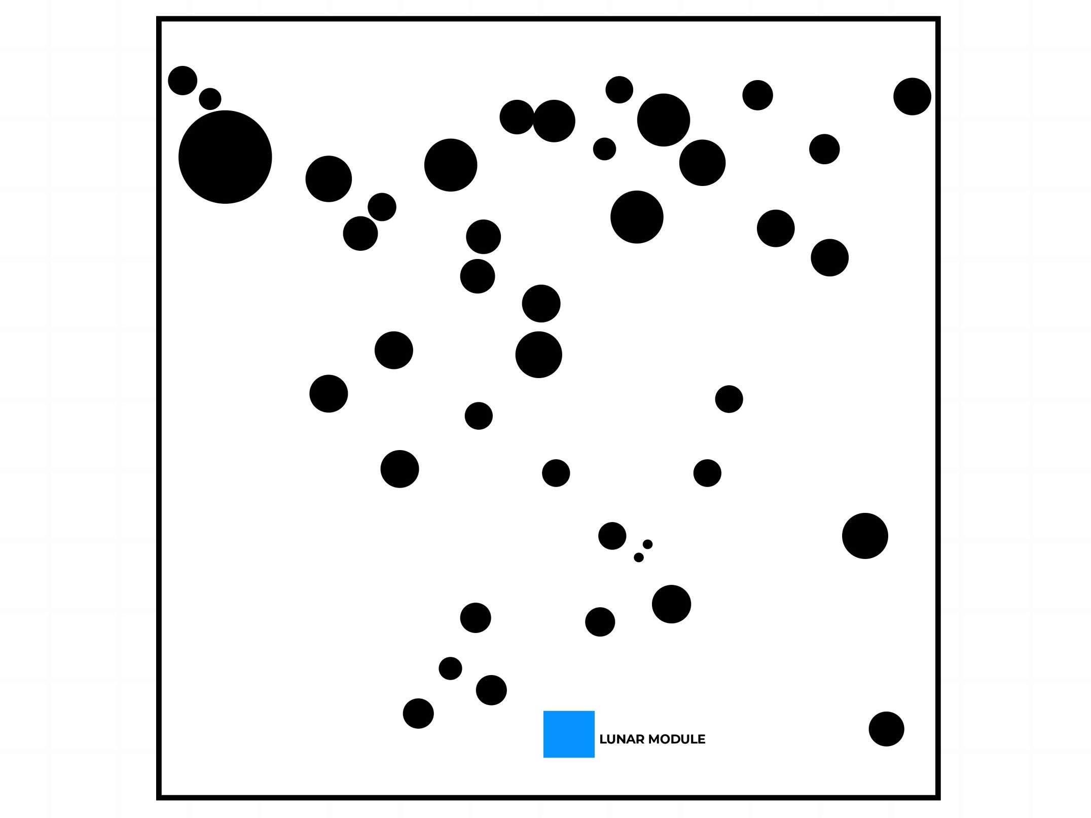
Nowadays, we are so familiar with just looking on Google maps and knowing exactly where we are in the world. Looking from above, it’s much easier to understand the geography of what’s around us – but when you’re on the surface, it becomes much harder to use the craters and rocks as reference points. On top of that, we don’t have the same sense of depth on the Moon.
Without an atmosphere, distant objects don’t have the same haziness as they do on Earth – and so a large rock placed really far away could easily be mistaken for a smaller one that’s much closer.
Even NASA had no idea what to do – but they were hoping that the test would reveal the quickest technique.
Each person was given this real satellite image of the Moon and 30 minutes to mark down where they thought they were. If they couldn’t locate their exact position after 30 minutes, they would be given progressively smaller maps, shrinking the search zone all the way down to just 1/64th of a kilometer. If after 4 hours they still couldn’t identify their location, they would fail the test. The results were pretty interesting.
Test results
Out of the 28 people, only 6 were able to find their location using the 1km map, 12 people found it using the second map, 8 people found it with the 3rd map, one person got it with the 4th map and one person failed the test. But what was the best method?
The test subjects started searching for various things: pairs of craters, larger groups of craters and lines of craters. You might think that a line of craters would be more noticeable and therefore lead to quicker success. But none of the 28 test subjects found their location using this method. Those that started off with this method eventually switched to a different method.
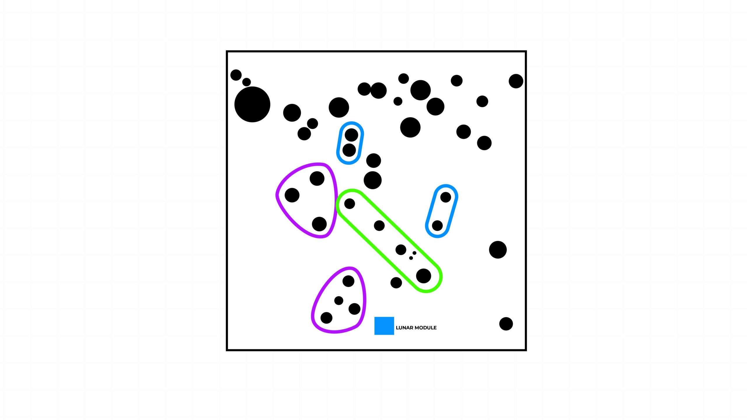
By far the most successful method was searching for pairs of craters. But why? NASA figured that remembering the shape of 2 craters was much easier than visualizing a much more complex array of craters. The key breakthrough for most of the test subjects was locating this pair of craters here. Despite many failing the first attempt, NASA were confident that with much more training and knowledge of the area, astronauts would be able to locate themselves fairly easily. But when it came time to walk on the surface, they needed to know what to look for.
After all, the Moon was a place completely untouched by humans. And so astronauts were effectively the eyes and hands for scientists back on Earth. In Cinder Lake, geologists started to train the astronauts on how to identify specific rocks and collect samples. They went through field exercises where they would communicate what they were seeing by radio back to a group of scientists. This is when NASA realized something.
Live video from the Moon
It became clear that it was really difficult to know what the astronauts were doing and where they were just with the radio. And so they started experimenting with transmitting live video from Cinder Lake. This made it so much easier for NASA and the astronauts to work together and thanks to this breakthrough, NASA decided to do a live broadcast for every Moon mission.
All in all, astronauts trained here until the Apollo program ended. Over the course of each mission, astronauts brought back more than 380kg of samples from 6 different areas on the Moon. Each sample was stored in a container that preserved them, allowing scientists to study completely untouched Moon samples to this day. All this was possible thanks to this small little field in Arizona.

